Anticipating territorial changes through prospective research

BULB, Brussels Urban Landscape Biennial, Brussels (Belgium), 2018
Client : Brussels Region, Bozar Museum
Team : Taktyk
Program : Prospective research for water urbanism in Brussels
Location : Brussels
Surface Area : N/A
Cost : 20 000 €
Date : 2018
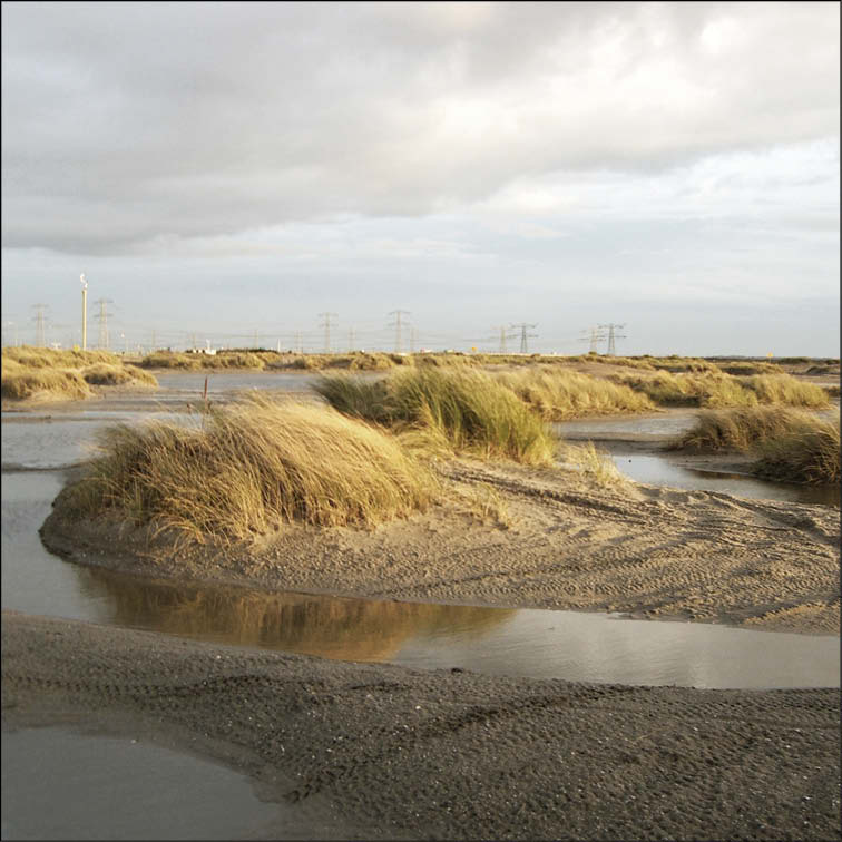
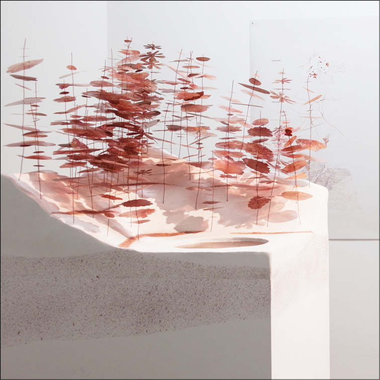
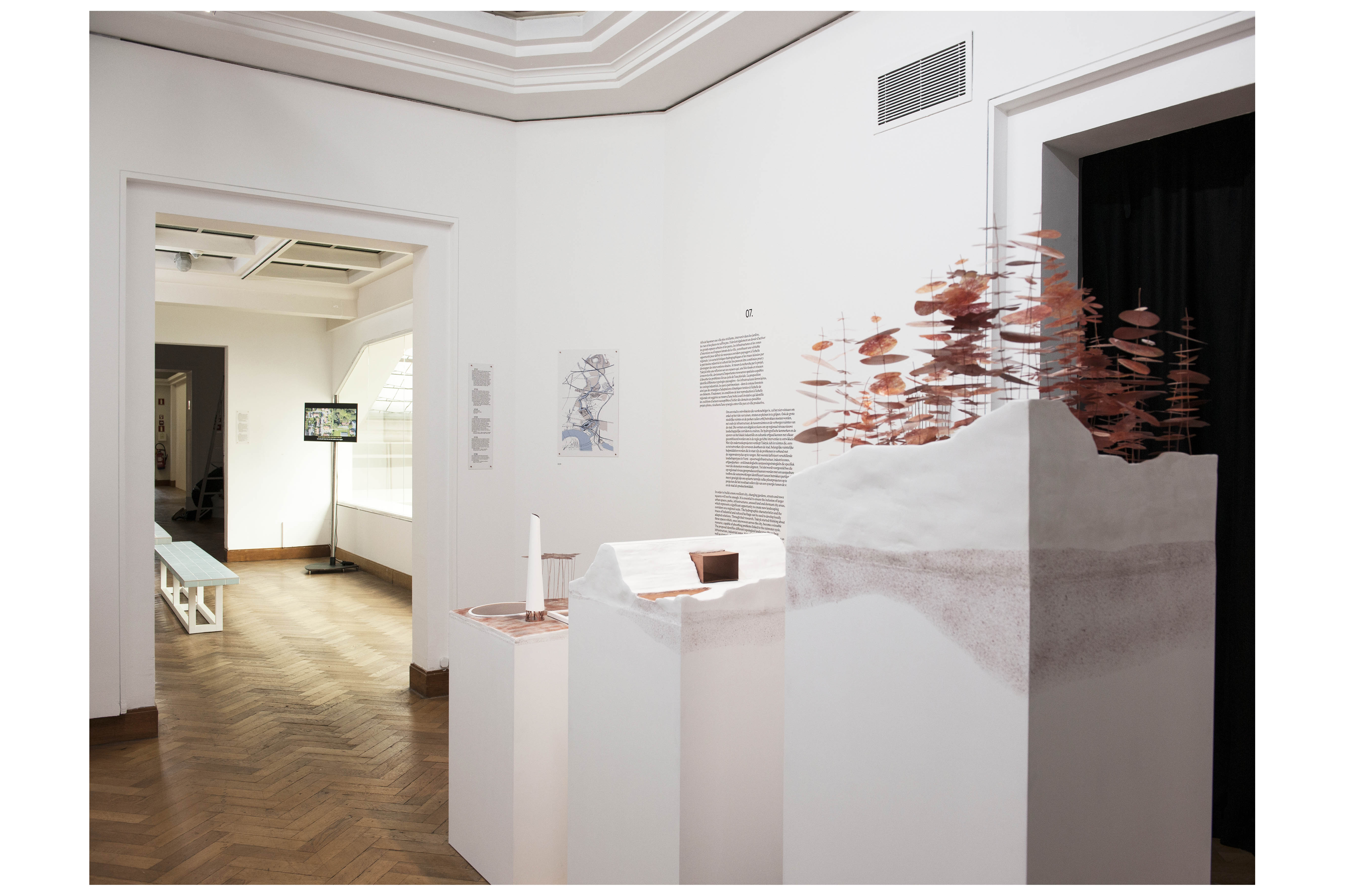
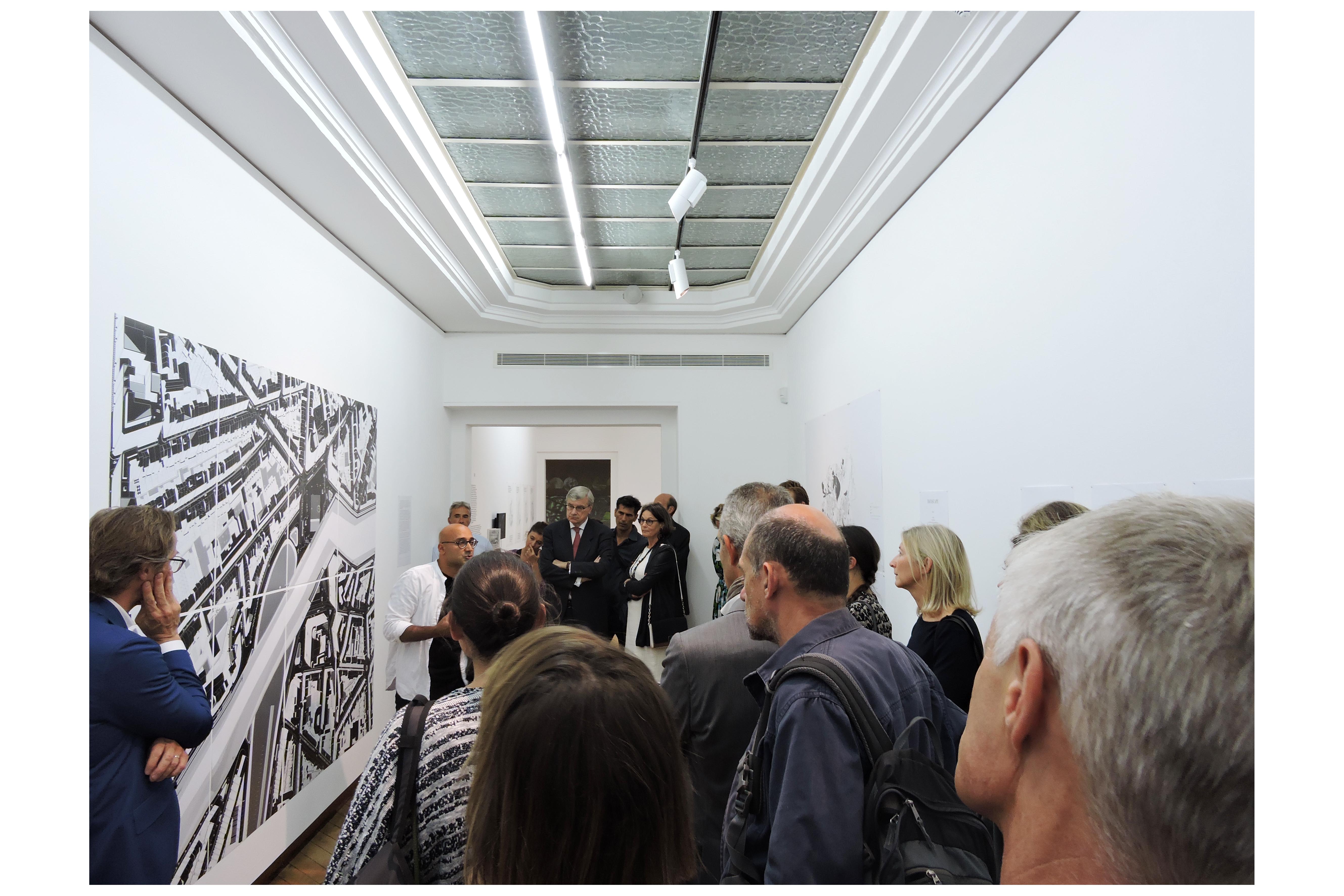
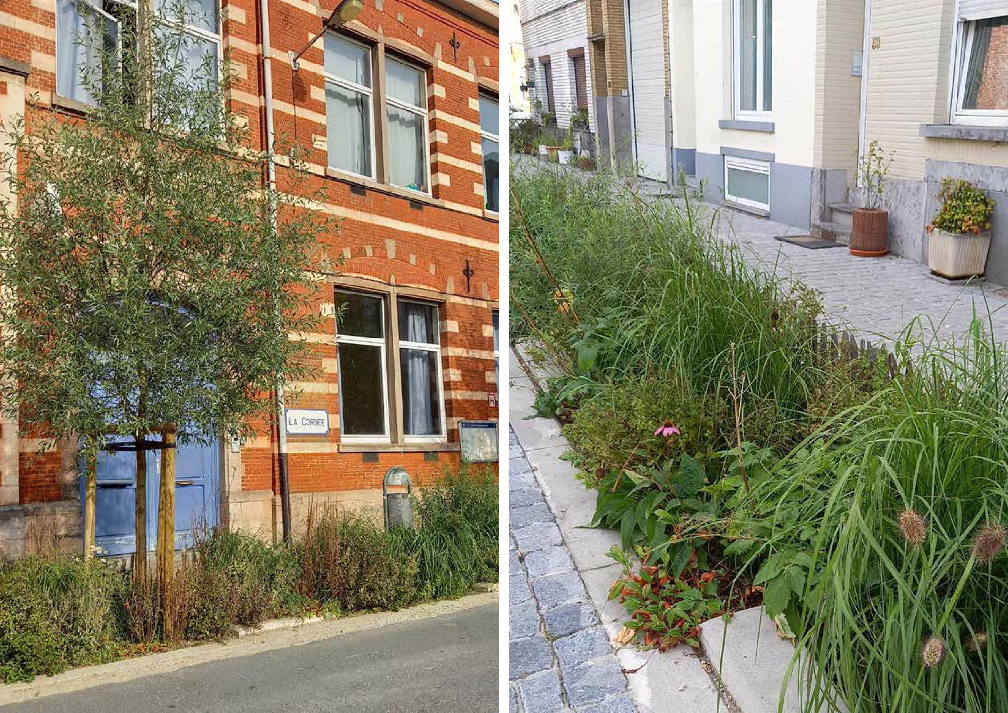
The second edition of the Brussels Urban Landscape Biennial (BULB) reviews the increasingly worrying issue of flooding in urban areas. How to manage the complex evacuation of rainwater in an integrated manner?
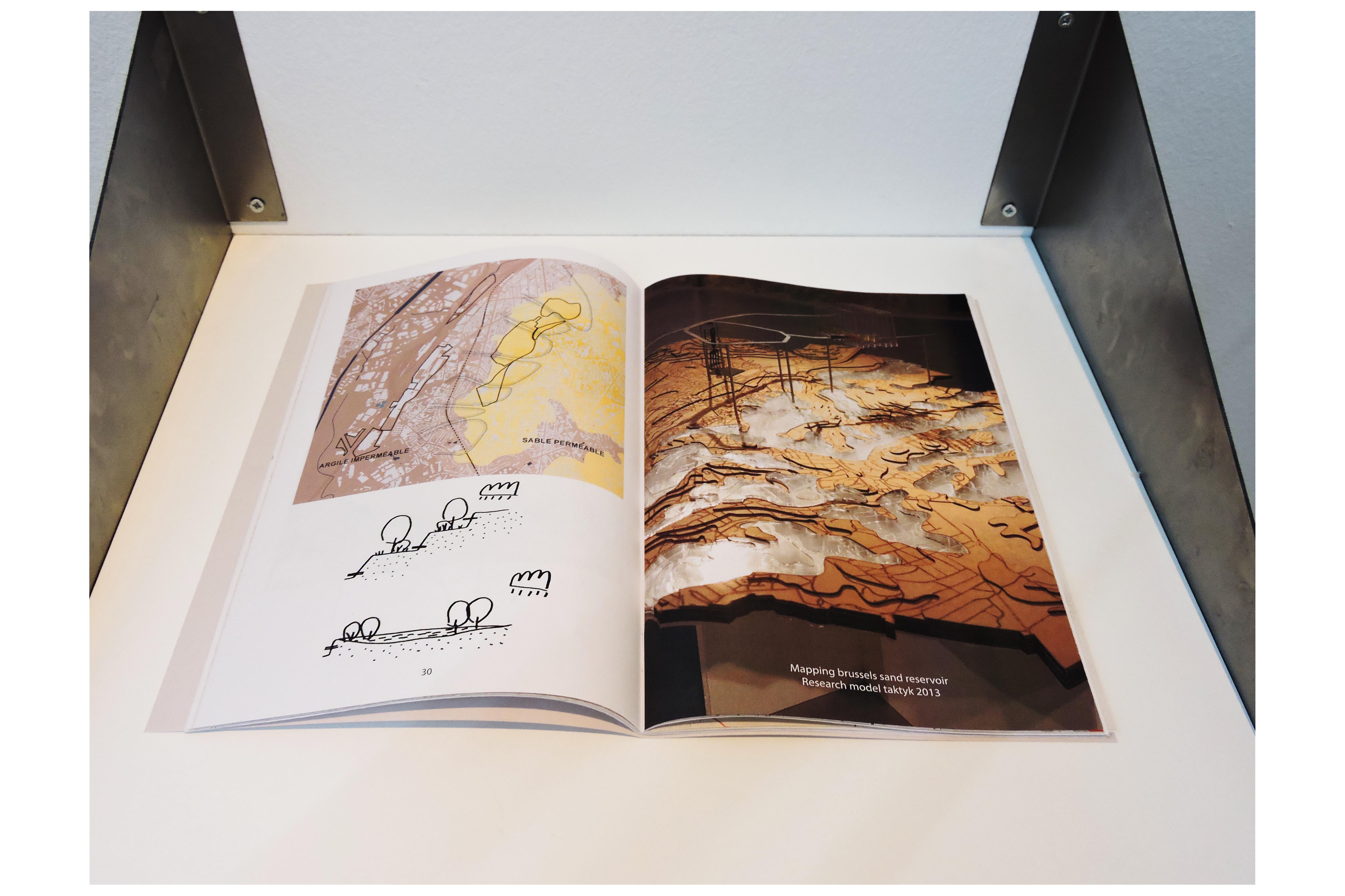
The biennale is a research tool. It enabled us to demonstrate that to fully respond to water stress along the watershed of Forest, the response needed to speed up actions and mobilize 10X more spaces that the “water matrix” envisioned by the city. We identified this as a leverage to mobilize frozen and latent landscapes in a water responsive strategy.
La deuxième édition de la Biennale du Paysage Urbain de Bruxelles (BULB) s’attache à explorer un enjeu urbain de plus en plus critique : celui des inondations.
Comment penser une gestion intégrée et efficace des eaux de pluie dans des territoires denses et contraints ? Conçue comme un outil de recherche, la biennale a permis de mettre en évidence un constat fort : pour répondre réellement au stress hydrique qui affecte le bassin versant de la commune de Forest, il est nécessaire d’amplifier les actions et de mobiliser jusqu’à dix fois plus d’espaces que ceux imaginée par la Ville.
Ce besoin d’espace devient alors un levier pour réactiver des paysages figés ou en attente, en les intégrant dans une stratégie territoriale sensible à l’eau.
WATER LINE, Forest (Belgium), 2016-2019
Client : City of Forest
Team : TAKTYK, INFRA Services
Program : Public Spaces
Location : Forest (Belgium)
Surface Area : 3 ha
Cost : 1 500 000 €
Date : 2016 – 2019
Client : City of Forest
Team : TAKTYK, INFRA Services
Program : Public Spaces
Location : Forest (Belgium)
Surface Area : 3 ha
Cost : 1 500 000 €
Date : 2016 – 2019
This consultation is an opportunity to approach water as a common good. In the context of Brussels 2040, the logic of hydrosystems, the Senne valley and Voluwe valley, continue to be developed at the scale of the metropolis.
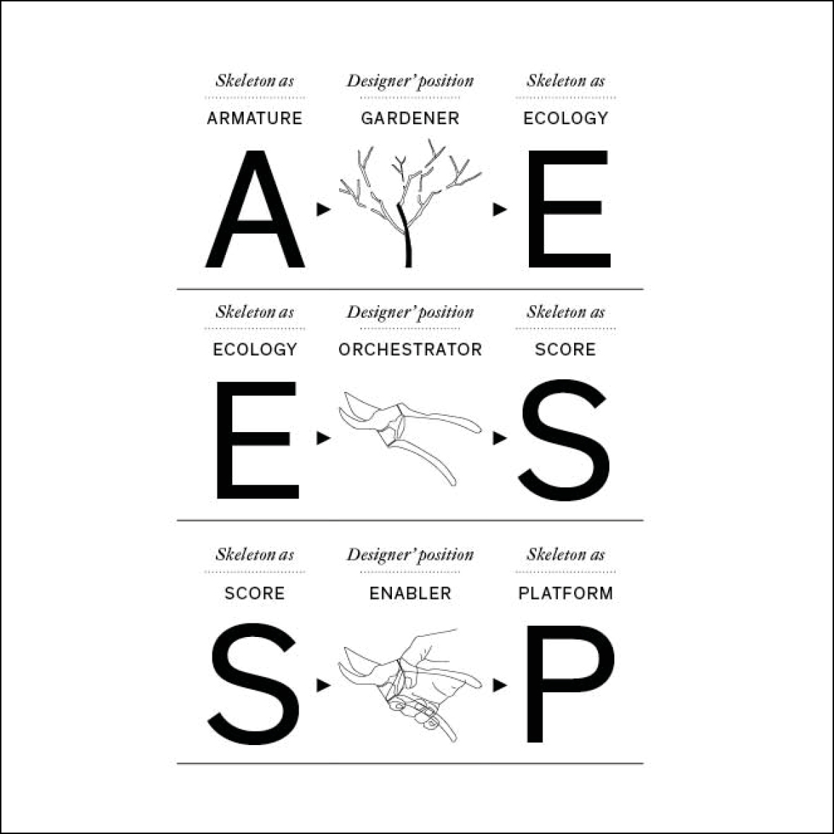
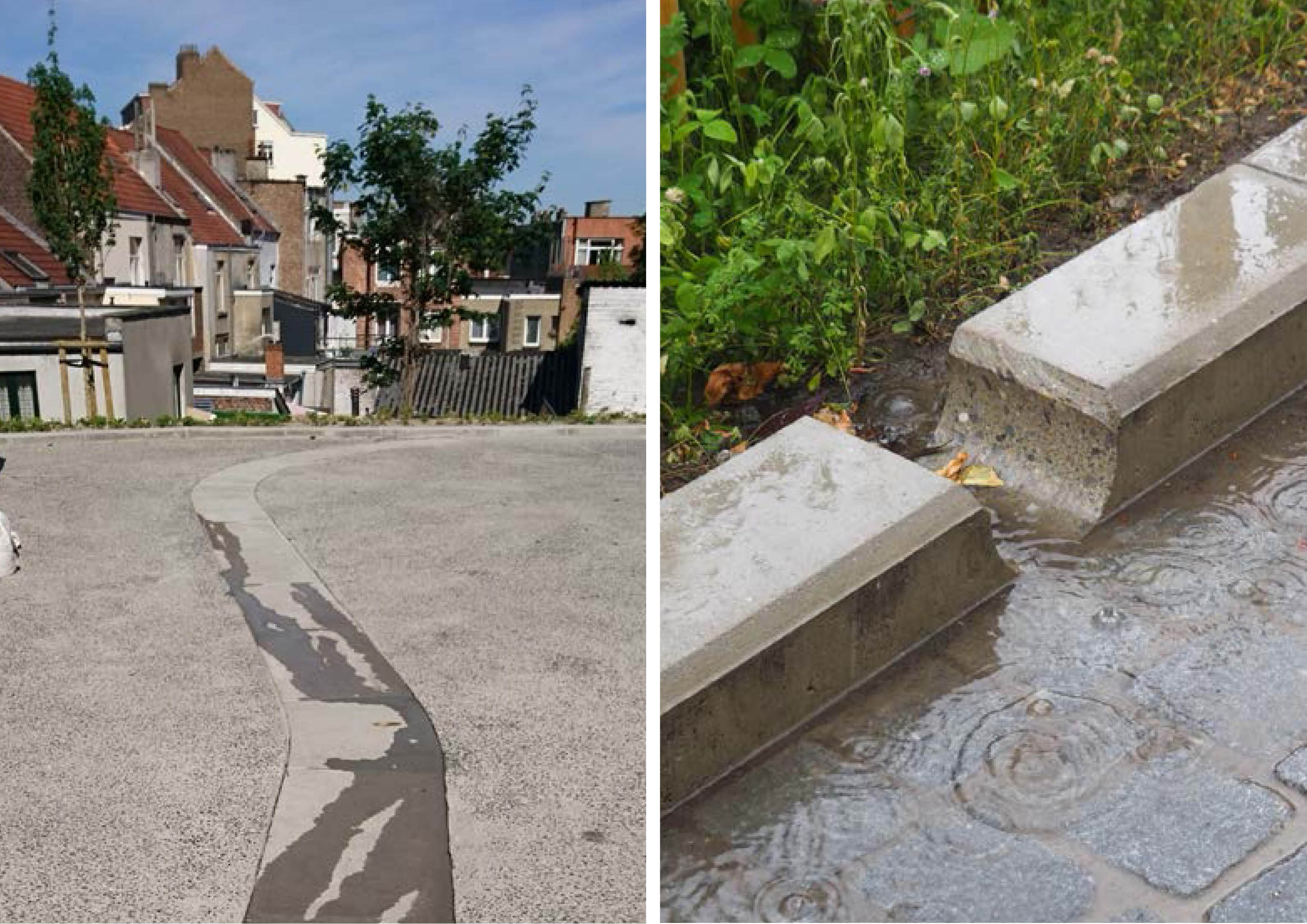
In Forest, it’s at the operational scale of the watershed that we mobilized. How can we retain rainwater by creating supports for new uses? The route of the water retains water from the watershed, contributes to the mesh of man and life, and stimulates new experiences of space. The risk of water becomes a subject, an opportunity for the emergence of a collective project. The work of the neighborhood contract and civic engagement are demonstrative of the recognition of the issues and expectations that are exerted through this consultation.
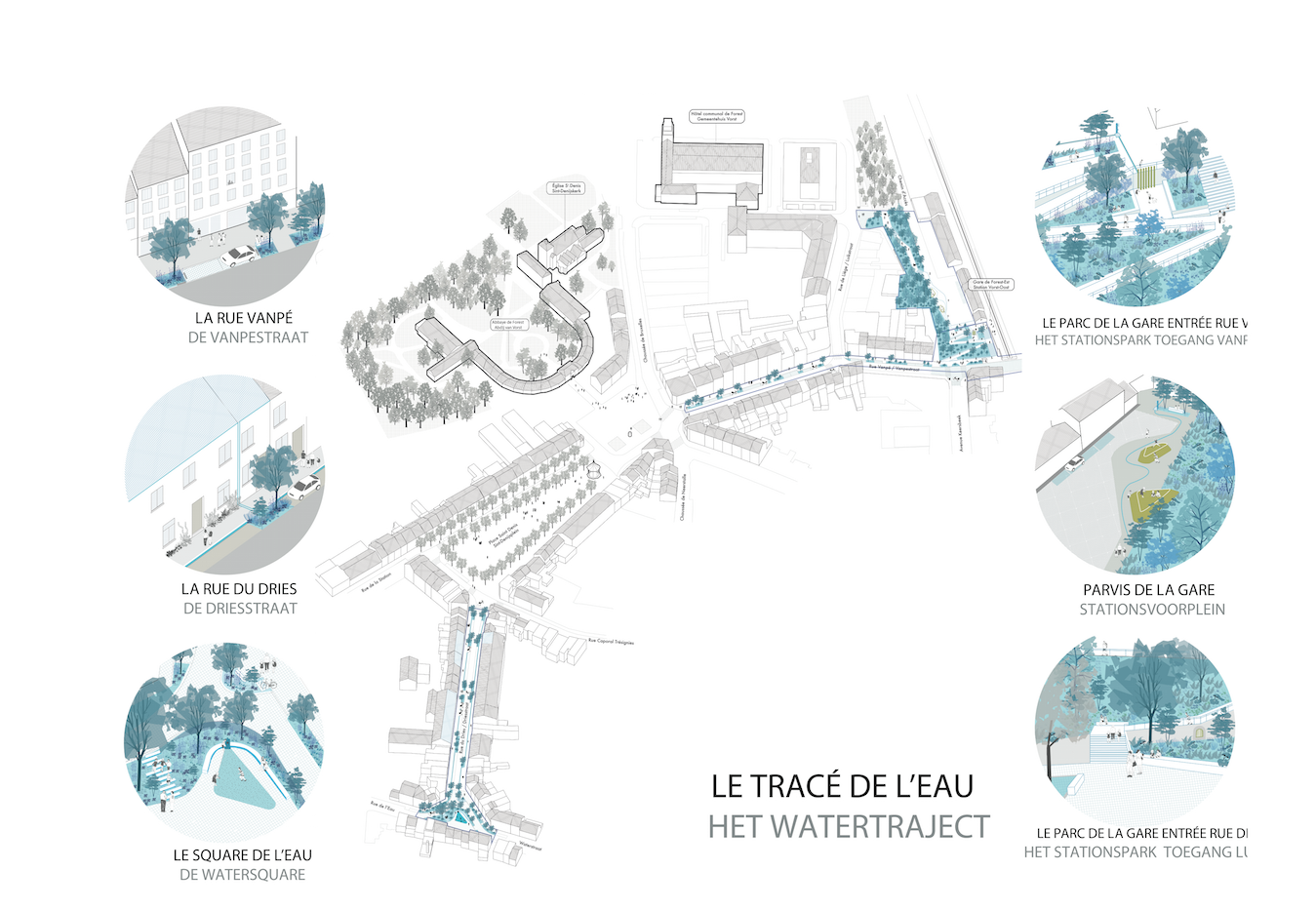
A strategic project
Tracé de l’eau is an opportunity to improve the hydrological behavior of the watershed. We also understand that the objective of the project of public space in a dilated communal territory, is to accompany the invention of a communal urbanity that extends from the station of Forest East to the place Saint-Denis. On this scale, the future of the station near a civic and neighborhood pole and the affirmation of the Abbey as a cultural center are two strong levers that we have integrated into the agenda of public space.
An inventive tool box
In Forest, it’s at the operational scale of the watershed that we mobilized. How can we retain rainwater by creating supports for new uses? The route of the water retains water from the watershed, contributes to the mesh of man and life, and stimulates new experiences of space. The risk of water becomes a subject, an opportunity for the emergence of a collective project. The work of the neighborhood contract and civic engagement are demonstrative of the recognition of the issues and expectations that are exerted through this consultation.
A strategic project
Tracé de l’eau is an opportunity to improve the hydrological behavior of the watershed. We also understand that the objective of the project of public space in a dilated communal territory, is to accompany the invention of a communal urbanity that extends from the station of Forest East to the place Saint-Denis. On this scale, the future of the station near a civic and neighborhood pole and the affirmation of the Abbey as a cultural center are two strong levers that we have integrated into the agenda of public space.
An inventive tool box
The creation of public space in Forest must show and test the work for future operations in the territory of the municipality.
Cette consultation est l'occasion d'aborder l'eau comme un bien commun. Dans le contexte de Bruxelles 2040, la logique des hydrosystèmes, la vallée de la Senne et la vallée de la Voluwe, continue d'être développée à l'échelle de la métropole.
À Forest, c'est à l'échelle opérationnelle du bassin versant que nous nous sommes mobilisés. Comment retenir les eaux pluviales en créant des supports pour de nouveaux usages ? Le parcours de l'eau retient l'eau du bassin versant, contribue au maillage de l'homme et de la vie, et stimule de nouvelles expériences spatiales. Le risque lié à l'eau devient un sujet, une opportunité pour l'émergence d'un projet collectif. Le travail du contrat de quartier et l'engagement citoyen témoignent de la reconnaissance des enjeux et des attentes exprimés par cette consultation.
Un projet stratégique
« Tracé de l'eau » offre une opportunité d'améliorer le comportement hydrologique du bassin versant. Nous comprenons également que l'objectif du projet d'espace public sur un territoire communal dilaté est d'accompagner l'invention d'une urbanité communale qui s'étend de la gare de Forest Est à la place Saint-Denis. A cette échelle, le devenir de la gare à proximité d’un pôle civique et de quartier et l’affirmation de l’Abbaye comme pôle culturel sont deux leviers forts que nous avons intégrés à l’agenda de l’espace public.
Une boîte à outils inventive
La création d’espace public à Forest doit montrer et tester le travail pour les opérations futures sur le territoire de la commune.